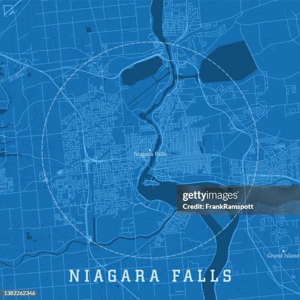
niagara falls on city vector road map blue text - niagara falls map stock illustrationsNiagara Falls ON City Vector Road Map Blue Text
cartoon map of northeastern u.s. - niagara falls map stock illustrationsCartoon map of Northeastern U.S.
old map of province of ontario, canada, details of niagara falls, 1890s, 19th century - niagara falls map stock illustrationsOld Map of Province of Ontario, Canada, details of Niagara Falls, 1890s, 19th Century
canada themed map design elements hand drawn - niagara falls map stock illustrationsCanada themed map design elements hand drawn
map of the niagara falls, canada, usa, woodcut, published 1897 - niagara falls map stock illustrationsMap of the Niagara Falls, Canada, USA, woodcut, published 1897
map of new york - watercolor style - niagara falls map stock illustrationsMap of New York - Watercolor style
old engraved map of niagara river - niagara falls map stock pictures, royalty-free photos & imagesOld engraved map of Niagara river
old chromolithograph map of ontario, province of canada - niagara falls map stock pictures, royalty-free photos & imagesOld chromolithograph map of Ontario, province of Canada
canada themed map design elements hand drawn - niagara falls map stock illustrationsCanada themed map design elements hand drawn
Satellite image of the American Great Lakes : lake Superior, Michigan, Huron, Erie and Ontario. This image was compiled from data acquired by LANDSAT...Great Lakes, Usa & Canada, True Colour Satellite Image
antique map of niagara river area during the war of 1812 - 19th century - niagara falls map stock illustrationsAntique Map of Niagara River Area during the War of 1812 - 19th Century
buffalo satellite topographic map 3d render true color - niagara falls map stock pictures, royalty-free photos & imagesBuffalo Satellite Topographic Map 3D Render True Color
canada themed map design elements hand drawn - niagara falls map stock illustrationsCanada themed map design elements hand drawn
buffalo, new york, usa vector map - niagara falls map stock illustrationsBuffalo, New York, USA Vector Map
usa, new york, niagara falls, satellite image - niagara falls map stock pictures, royalty-free photos & imagesUSA, New York, Niagara Falls, satellite image
map of great lakes and forest map - niagara falls map stock illustrationsMap of Great Lakes and forest Map
old engraved map of revolutionary posts in the highlands of the hudson and the lower part of that river - niagara falls map stock pictures, royalty-free photos & imagesOld engraved map of Revolutionary posts in the highlands of the Hudson and the lower part of that river
Map of Louisiana , Johann Baptista Homann, 1664 – 1724, Etching and engraving, hand-colored, on white laid paper, Map of Louisiana shows the Eastern...Map
volcanoes, geysers and water falls engraving - niagara falls map stock illustrationsVolcanoes, Geysers and Water Falls Engraving
power county, idaho. map on white background with red banner - niagara falls map stock illustrationsPower County, Idaho. Map on white background with red banner
buffalo, new york, usa vector map - niagara falls map stock illustrationsBuffalo, New York, USA Vector Map
old engraved map of revolutionary posts in the highlands of the hudson and the lower part of that river - niagara falls map stock pictures, royalty-free photos & imagesOld engraved map of Revolutionary posts in the highlands of the Hudson and the lower part of that river
canada themed map design elements hand drawn - niagara falls map stock illustrationsCanada themed map design elements hand drawn
Color lithographic trade card published by Donaldson Brothers for Arbuckle Coffee depicting a map of the New York State, The card depicts highlights...Trade Card for New York State
Tourist reads a map in Niagara Falls, Ontario, Canada, on Wednesday, June 21, 2017. The 150th anniversary of Canada, promoted as Canada 150, marks...Tourists Visit Niagara Falls Ahead Of Canada's 150th Anniversary Celebration
Washington D.C.- James Clark, of Niagara Falls, NY, with the Love Canal Homeowners Association, uses a photo showing the polluted area near the canal...James Clark Points To Map Before Mic.
Everything was backwards when Roy Teal; system supervisor at the Ontario Hydro control centre at Richview substation near Malton; examined...Everything was backwards when Roy Teal; system supervisor at the Ontario Hydro control centre at Ric...
old engraved map of niagara river - niagara falls map stock pictures, royalty-free photos & imagesOld engraved map of Niagara river
power county, idaho. maps on blue and red backgrounds - niagara falls map stock illustrationsPower County, Idaho. Maps on blue and red backgrounds
niagara county, new york. maps on blue and red backgrounds - niagara falls map stock illustrationsNiagara County, New York. Maps on blue and red backgrounds
power county, idaho. map with blue and red people - niagara falls map stock illustrationsPower County, Idaho. Map with blue and red People
niagara county, new york. map with blue and red people - niagara falls map stock illustrationsNiagara County, New York. Map with blue and red People
power county, idaho. map on blue and red background - niagara falls map stock illustrationsPower County, Idaho. Map on blue and red background