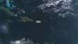
Puerto Rico map highlighted with border and country name, zooming in from the space through a 4K photo real animated globe, with a panoramic view consisting of Africa, West Europe and USA. Realistic epic spinning world animation, Planet Earth, Sea, Clouds - 4K stock video
World map set of all countries, Map resolution: 22000 x 11000 pixel, Epic photo real animation,
World Map Credits To NASA : https://visibleearth.nasa.gov


PURCHASE A LICENSE
All Royalty-Free licenses include global use rights, comprehensive protection, simple pricing with volume discounts available
$575.00
CAD
DETAILS
Credit:
Creative #:
1399047845
License type:
Collection:
Creatas Video
Max file size:
3840 x 2160 px - 84 MB
Clip length:
00:00:16:14
Upload date:
Location:
Puerto Rico
Release info:
No release required
Mastered to:
MPEG-4 8-bit H.264 4K 3840x2160 29.97p
Categories:
- Puerto Rico,
- Map,
- San Juan Province,
- Animated Video,
- 3D Animation,
- Country - Geographic Area,
- Globe - Navigational Equipment,
- Mountain,
- Three Dimensional,
- World Map,
- 4K Resolution,
- Aerial View,
- American Culture,
- Blue,
- Caguas - Puerto Rico,
- Central America,
- Cloud - Sky,
- Cloudscape,
- Continent - Geographic Area,
- Cut Out,
- Day,
- Digital Animation,
- Film - Moving Image,
- Flying,
- Geographical Border,
- HD Format,
- Highlighter Pen,
- Horizontal,
- International Border,
- Latin America,
- Latin American and Hispanic Culture,
- Marking Territory,
- Mayaguez,
- Name Tag,
- No People,
- Non US Film Location,
- Outer Space,
- Planet - Space,
- Planet Earth,
- Ponce,
- Satellite View,
- Sea,
- Sky,
- South America,
- Technology,
- Text,
- The Americas,
- Time Lapse,
- Topography,
- Travel,
- Travel Destinations,
- Zoom Effect,
- Zoom In,