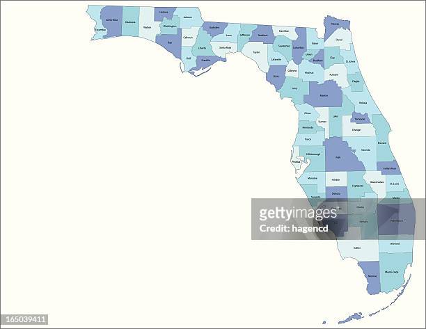
Florida Vector Map - stock illustration
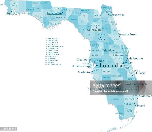
"Highly detailed vector map of Florida, United States. File was created on January 23, 2012. The colors in the .eps-file are ready for print (CMYK). Included files: EPS (v8) and Hi-Res JPG."

Easily modify images with AI
Add, replace, or remove parts of an image
Extend images to your desired height and width
Generate new, commercially-safe images
Get 25 generations for only $69.00
Learn more about AITo download content that you modify with AI, you'll need a royalty-free license.
Get this image in a variety of framing options at Photos.com.
PURCHASE A LICENSE
All Royalty-Free licenses include global use rights, comprehensive protection, simple pricing with volume discounts available
$375.00
CAD
Getty ImagesFlorida Vector Map High-Res Vector Graphic Download premium, authentic Florida Vector Map stock illustrations from Getty Images. Explore similar high-resolution stock illustrations in our expansive visual catalogue.Product #:165913329
Download premium, authentic Florida Vector Map stock illustrations from Getty Images. Explore similar high-resolution stock illustrations in our expansive visual catalogue.Product #:165913329$375$50
Getty Images
In stockMedium $375
DETAILS
Credit:
Creative #:
165913329
License type:
Collection:
DigitalVision Vectors
Max file size:
4094 x 4096 px (37.22 x 37.24 in) - 110 dpi - 6 MB
Upload date:
Release info:
Model and property released
Categories:
Similar images


- Map,
- Florida - US State,
- Miami,
- West Palm Beach,
- Jacksonville - Florida,
- Central Florida,
- Clearwater - Florida,
- Florida Keys,
- St. Petersburg - Florida,
- Tallahassee,
- Atlantic Ocean,
- Blue,
- Bradenton,
- Clip Art,
- Color Image,
- Daytona Beach,
- Digitally Generated Image,
- Everglades National Park,
- Fort Lauderdale,
- Geology,
- Green Color,
- Gulf Coast States,
- Gulf of Mexico,
- Illustration,
- Lake Okeechobee,
- Latitude,
- Longitude,
- No People,
- Non-Urban Scene,
- North America,
- Orlando - Florida,
- Physical Geography,
- Satellite View,
- Tampa,
- USA,
- Vector,
- View Into Land,